Drone Mapping Newcastle and North East
Drone Mapping / Photogrammetry Newcastle Upon Tyne
Drone Mapping Newcastle. Providers of drone data capture to generate mapping and 3d imagery. Our 3D drone mapping Northumberland and the North East is used by many industries. These are construction, heritage, housing development, infrastructure, road networks. Give us a call for your drone mapping Northumberland. Forestry drone mapping northumberland.
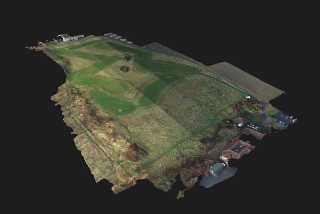
Mapping by drones North East. Orthomosiac, photogrammetry specialists. NADIR images and LIDAR systems can be used to generate maps. Point clouds, elevation models, volumetric measurements. With GCPs we can provide survey grade imagery. Provider of drone mapping Newcastle, offering the highest standards.
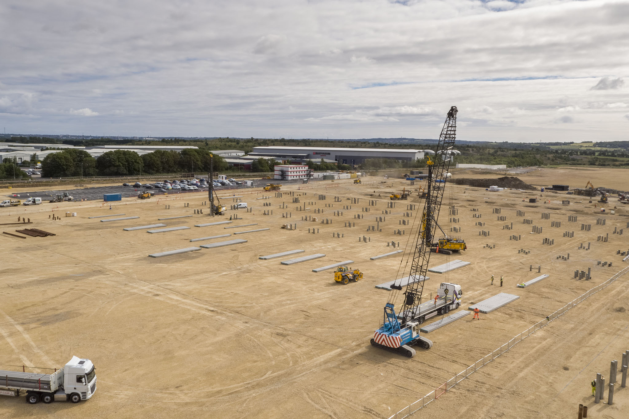
Dropzone Images provide professional 3D drone mapping and photogrammetry services for buildings and landscapes, providing essential coverage of locations or events, including, development sites, heritage buildings, natural disasters, hurricanes, accident sites, forestry, sandbanks, tidal, algae, and geological areas of interest.
Our experienced drone operators can capture high-quality footage and mapping of any terrain, providing an aerial land survey to assist architects, builders, or surveyors. With the use of Ground Control Points (GCPs) these can delivered with survey grade accuracy.
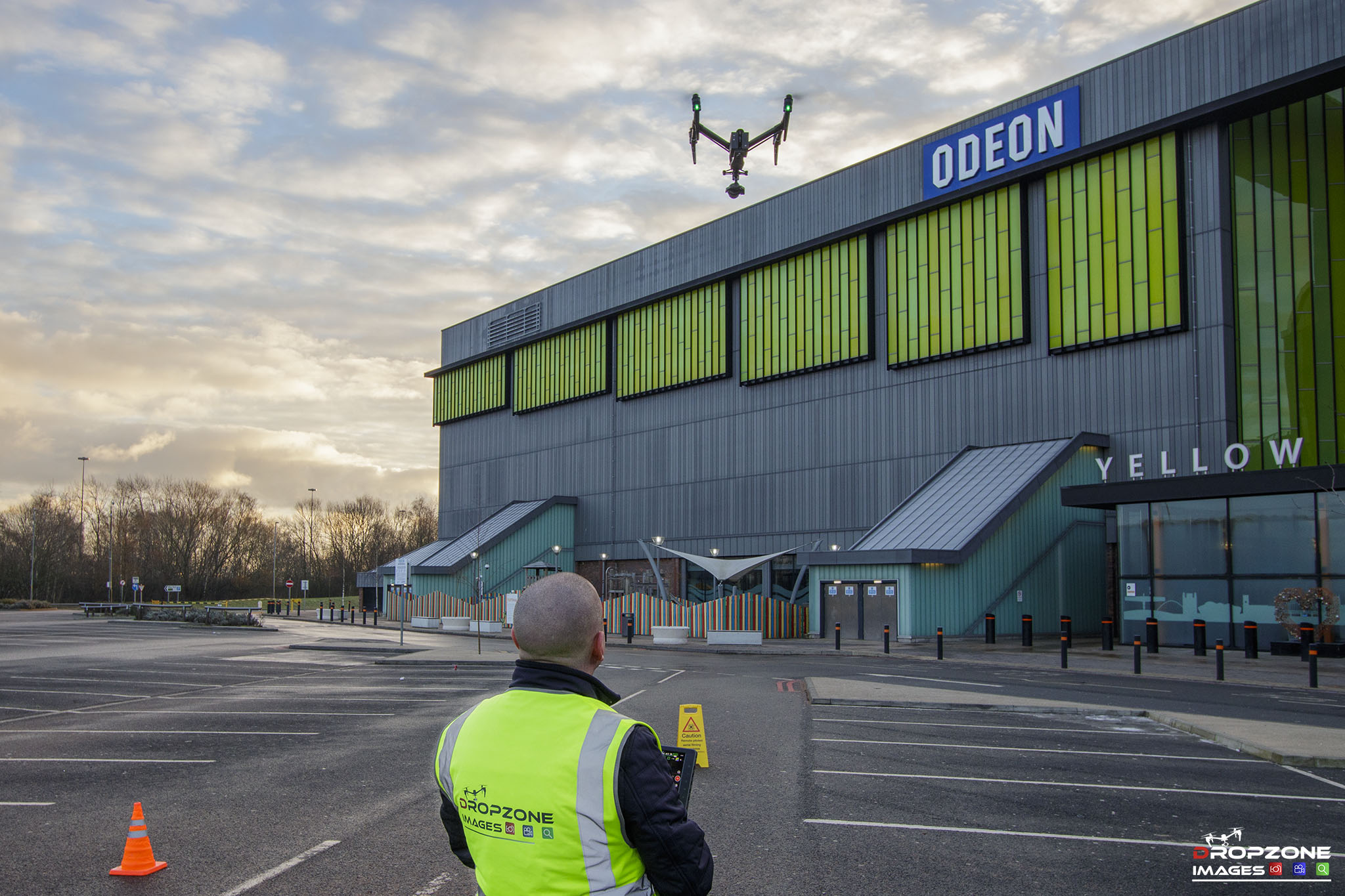
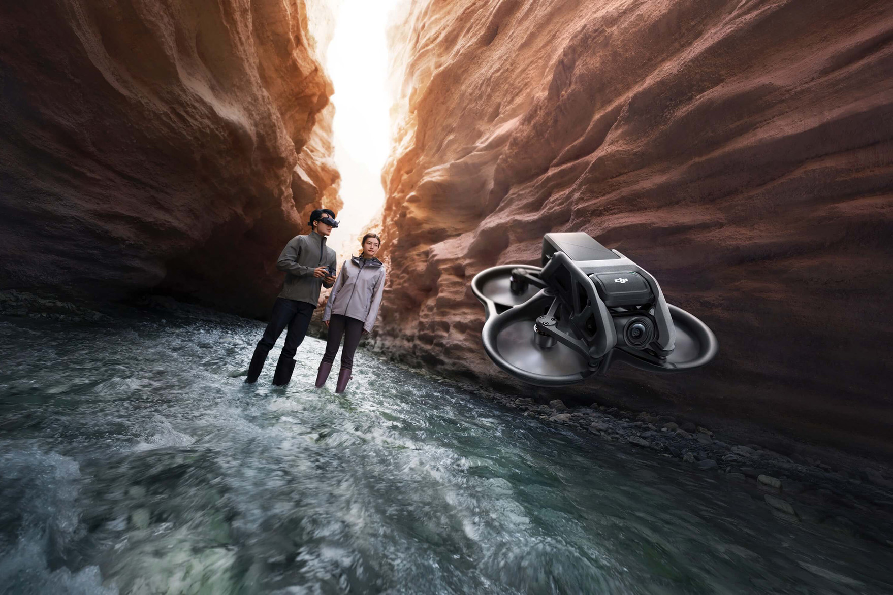
The DJI Phantom 4 Pro is our drone of choice for mapping and data collecting missions due the the reliability and high quality camera with mechanical shutter for clean sharp images.


Drone Mapping North East
Data Capture
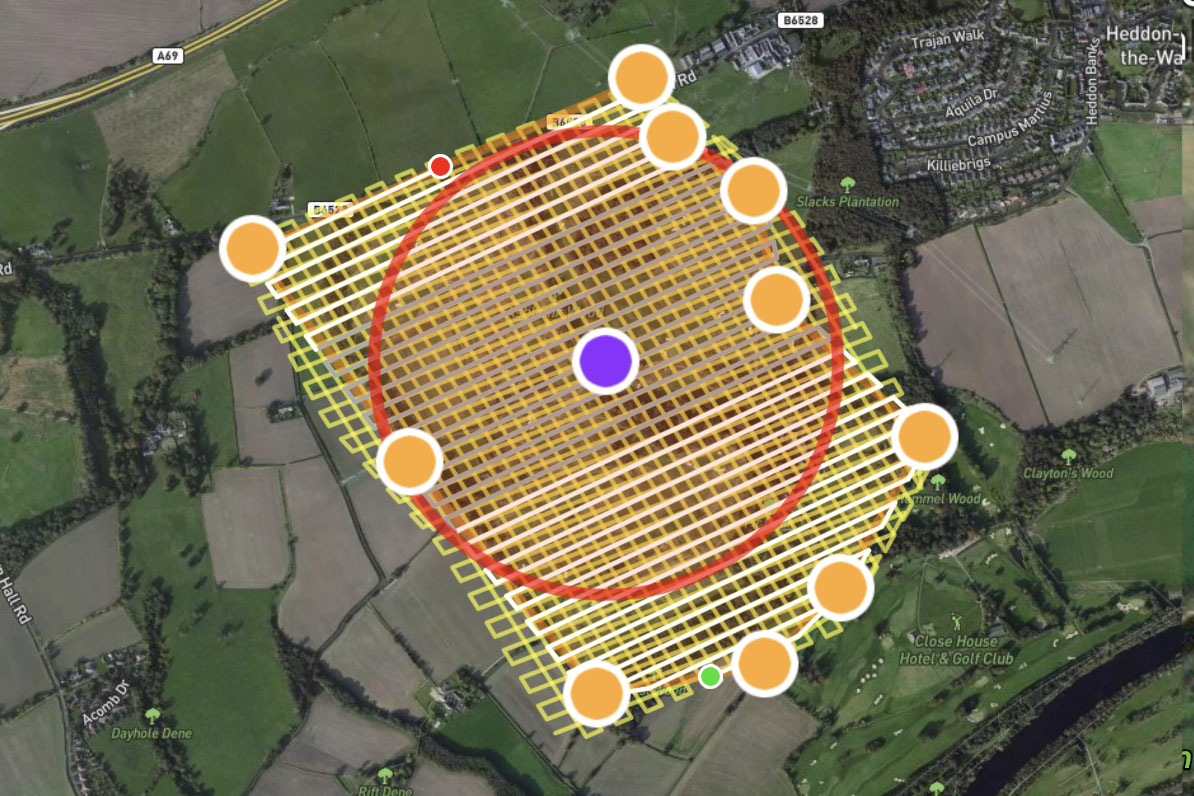
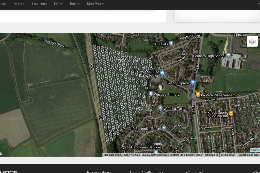
Following initial consultations, plans are drawn up to capture the required data. Missions are created in various apps such as Maps Made Easy and Dronedeploy to enable automated flights to capture the data.
Data Processing
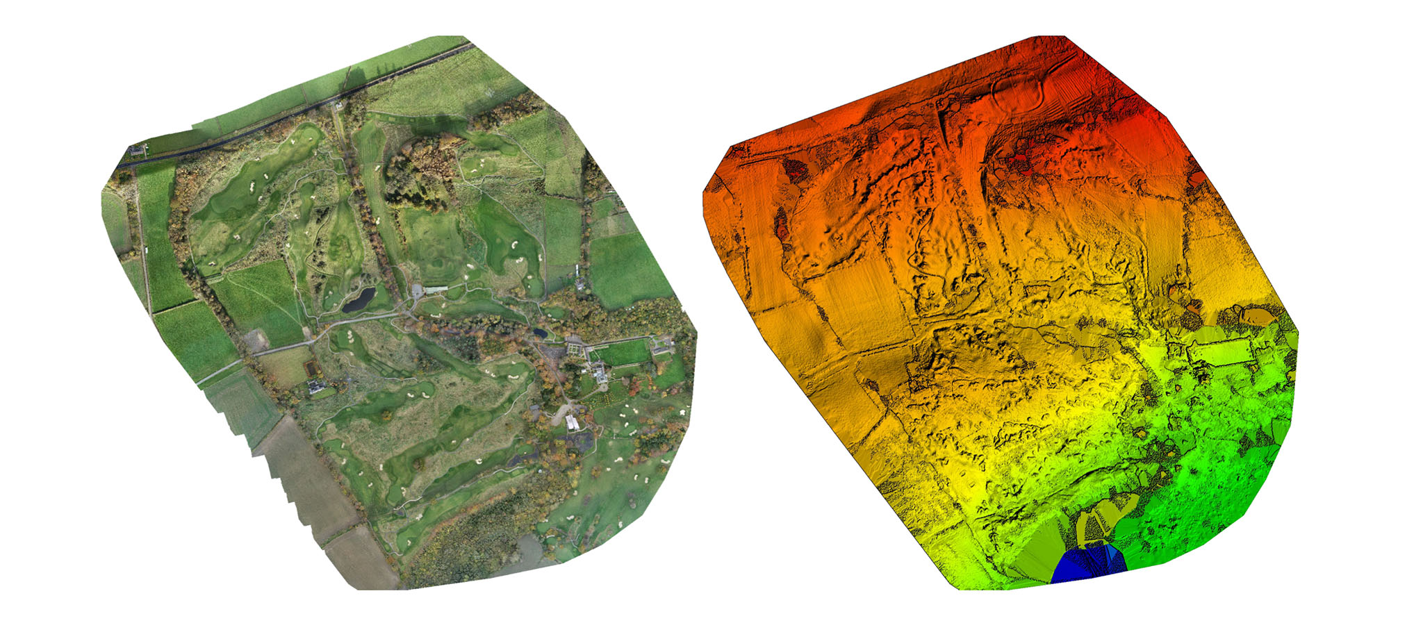
Captured data is processed through Pix4D. Pix4D analyses the quality of the images that have been collected and identifies any issues that may need addressed. Our experienced operators rarely encounter any quality issues and the data is processed successfully.
Delivered outputs
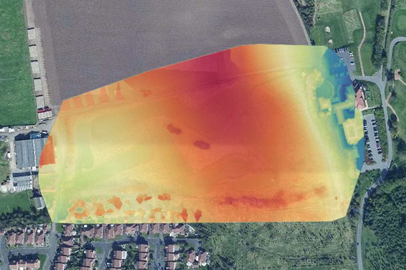
Final outputs to meet our clients requirements are transferred digitally via our own data transfer system. Typical output files include a Digital Surface Model (DSM), Orthomosaic tif, processing report pdf and a Point Cloud (LAS)
Are you ready to transform your projects with innovative drone mapping services? At Dropzone Images, our cutting-edge technology and aerial expertise provide a fresh perspective on your environment in the Newcastle and North East of England. Our services are cost-effective, efficient, and safe, helping you make informed decisions while saving time and resources.
Benefits of Drone Mapping in the North East of England:
Precision Mapping: Our drones equipped with advanced sensors and cameras deliver highly accurate geospatial data across the Newcastle and the North East. Whether it’s topographic mapping, 3D modeling, or orthomosaic imagery, we provide precision and detail.
Time Efficiency: Drone mapping significantly reduces data collection time. Projects that once took weeks can now be completed in days, allowing you to stay on schedule and within budget across the North East.
Enhanced Safety: By utilizing drones for mapping, you eliminate the need for humans to operate in challenging or hazardous environments. Safety is paramount in all our services, especially in the North East of England.
Real-time Data: Our drone mapping services offer real-time data updates, enabling you to make timely decisions. This feature is vital for construction, agriculture, and environmental monitoring across the North East.
Drone Mapping Applications in the North East of England:
Construction and Development: Monitor construction progress, site changes, and compliance with project plans across the North East. Real-time data ensures you can adjust as needed.
Agriculture: Optimize crop management with vegetation analysis, soil mapping, and irrigation planning. Precision agriculture is now at your fingertips in the North East of England.
Environmental Monitoring: Keep an eye on environmental changes such as forest health, wildfire risk, coastal erosion, and wildlife habitats across the North East.
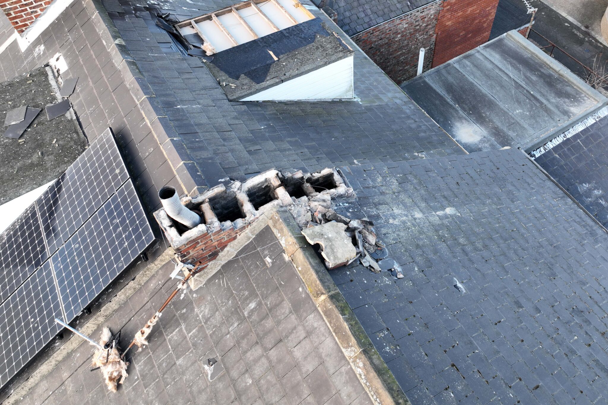
Infrastructure Inspection: Conduct thorough inspections of infrastructure like bridges, power lines, pipelines, and more. Early issue identification saves time and resources in the North East.
Emergency Response: Drones play a critical role in search and rescue, disaster response, and damage assessment. Quick deployment can save lives and resources in emergencies across the North East.
Why Choose Dropzone Images for Drone Mapping in the North East of England?
At Dropzone Images, we are dedicated to pushing the boundaries of drone mapping across the North East of England. Our experienced team uses the latest technology and software to deliver high-quality geospatial data tailored to your specific project requirements.
Experience the transformative power of precision mapping, time efficiency, and enhanced safety with Dropzone Images. Contact us today to discuss your drone mapping needs and revolutionize your projects across the North East of England.
DRONE PHOTOGRAPHY SERVICES
- Newcastle Upon Tyne Drone photography
- Ponteland Drone photography
- Gosforth Drone photography
- Wideopen Drone photography
- Cramlington Drone photography
- Wallsend Drone photography
- Longbenton Drone photography
- Killingworth Drone photography
- Drone roof inspection Newcastle
- Drone video Newcastle
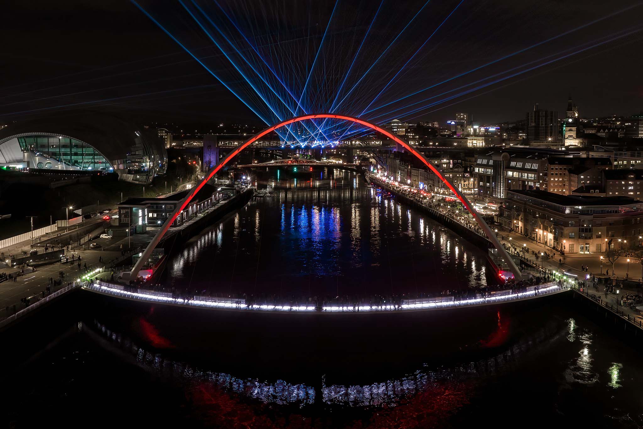
- Gateshead Drone filming
- Low Fell Drone filming
- Drone filming Angel of the North
- Team Valley Drone filming
- Whickham Drone filming
- Blaydon Drone filming
- Jarrow Drone inspections
- Hebburn Drone inspections
- South Shields Drone inspections
- Boldon Colliery Drone inspections
- Whitburn Drone inspections
- Cleadon Drone inspections
- Washington Drone inspections
- South Shields Drone inspections
- North Shields Drone pilot
- Tynemouth Drone pilot
- Whitley Bay Drone pilot
- Silverlink Drone pilot
- Earsdon Drone pilot
- Shiremoor Drone pilot
- Seaton Deleval Drone pilot
- Blyth Drone pilot
- Northumberland Drone hire
- Ashington Drone hire
- Choppington Drone hire
- Bamburgh Drone hire
- Amble Drone hire
- Alnwick Drone hire
- Seahouses Drone hire
- Belford Drone hire
- Morpeth Drone hire
- Alnmouth Drone hire
- Berwick Drone hire
- Wooler Drone hire
- Rothbury Drone hire
AERIAL VIDEOGRAPHY SERVICES
- Sunderland Aerial photography
- Roker Aerial photography
- Seaburn Aerial photography
- Penshaw Aerial photography
- Seaham Aerial photography
- New Herrington Aerial photography
- Houghton le Spring Aerial photography
- Hylton Castle Aerial photography
- Durham Drone videography
- Chester le StreetDrone videography
- Birtley Drone videography
- Peterlee Drone videography
- Fishburn Drone videography
- Trimdon Drone videography
- Consett Drone videography
- Stanley Drone videography
- Crook Drone videography
- Barnard Castle Drone videography
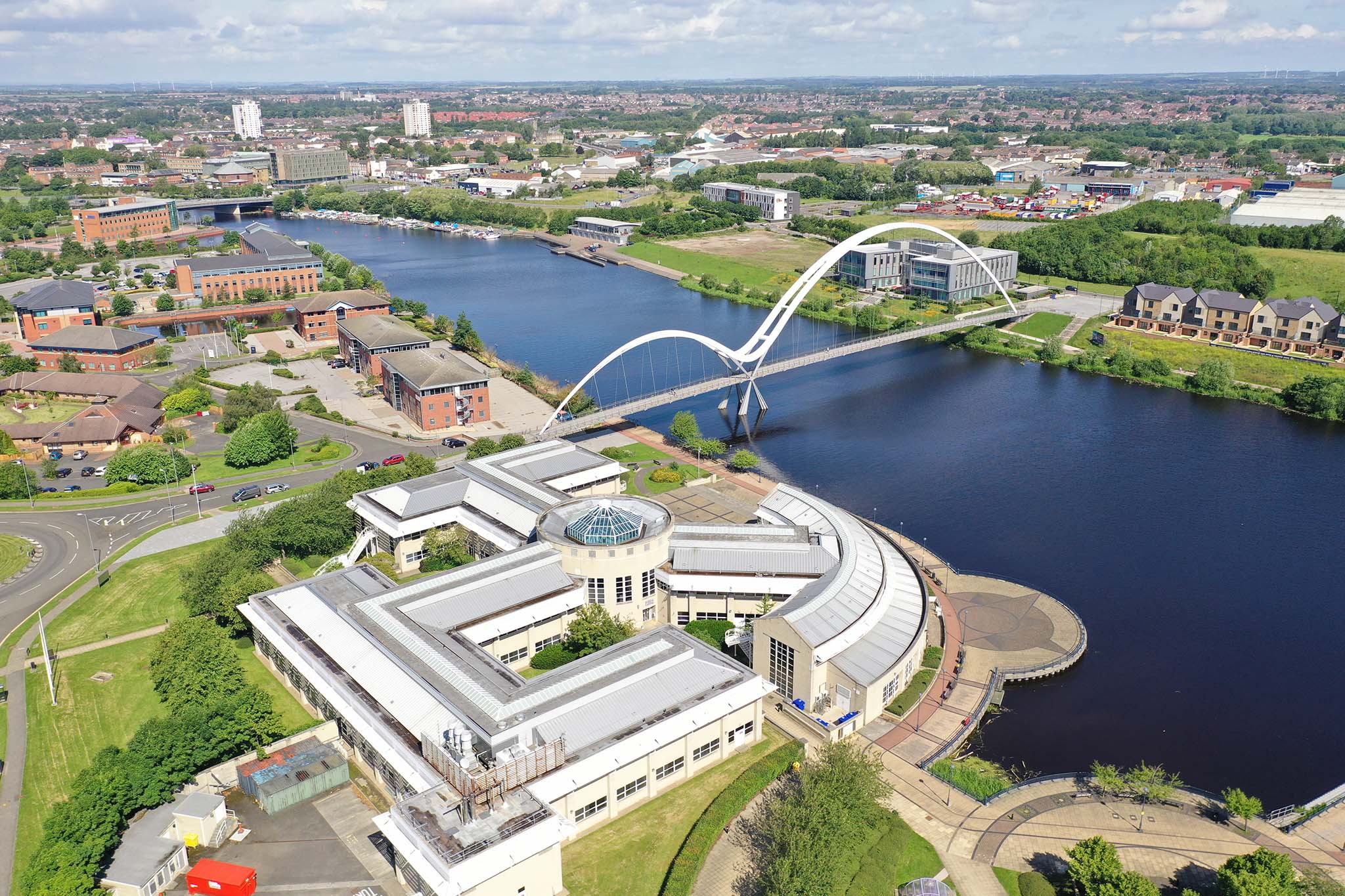
- Teesside Aerial photography
- Middlesbrough Aerial photography
- Hartlepool Aerial photography
- SedgefieldAerial photography
- Stokesley Aerial photography
- Yarm Aerial photography
- Stockton Aerial photography
- Guisborough Aerial photography
- Darlington Drone operator
- Northallerton Drone operator
- Newton Aycliffe Drone operator
- North Yorkshire Drone video
- Bedale Drone video
- Leyburn Drone video
- Catterick Drone video
- Richmond Drone video
- Leeming Bar Drone video
- Brompton Drone video